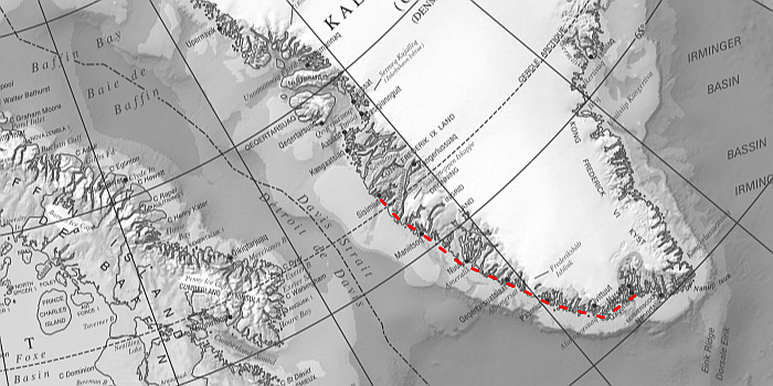
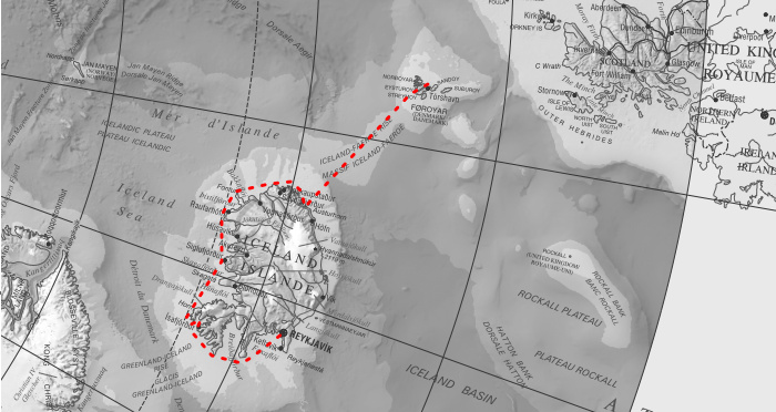
| LEG
6 : 580 miles : crew 6 : 10 days |
|
| Background source : Atlas of Canada
- The North polar region, see atlas.gc.ca
|
Leg
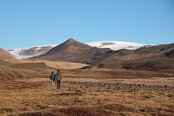
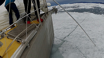
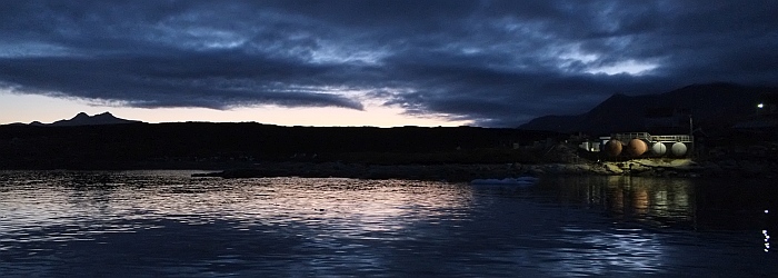
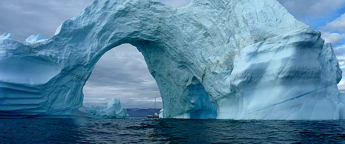
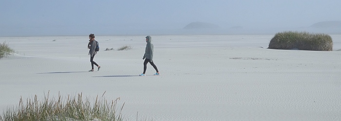
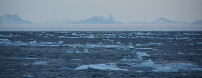
6 : Arrival in Qaanaaq (September 9th, 2015)
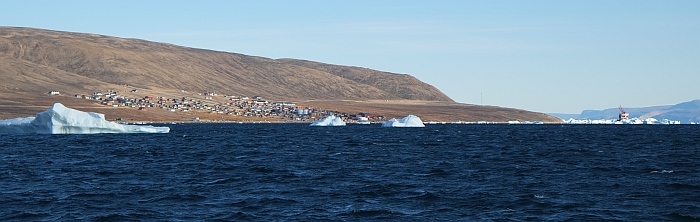
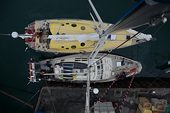
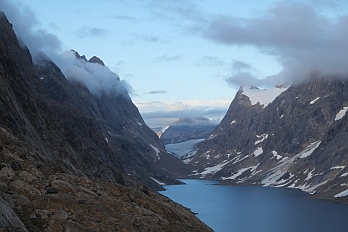
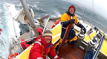
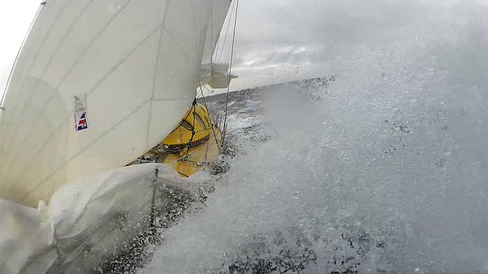
Qaanaaq, Inglefield Bredning, 77°28' N. To the right hand
the Arina Arctica, the last supply ship before winter
(photo Peter Gallinelli)
Qaanaaq (*), september 9th, we have arrived at our destination,
at the end of the 6th and last leg of this first big chapter,
the place we have dreamed of for many years. To finally be
here seems still unreal. Nanuq pulls on her anchor in a shallow
bay a few hundred metres away from the village, protected
from ice but not from the chilling wind blowing down from
the ice cap (***). We experience first snow on deck. Although
unheated, our contemporary 'passive
igloo' is cosy and warm.
Since our departure from Kopenhagen our log has counted 4700
nautical miles (~7500km). This kind of travel can't be compared
top sitting in an airplane zapping from one place to another.
We have sailed every wave, profited from every breeze, rounded
many caps and seen thousands of different unique viewpoints
along the way. We have had moments of waiting, doubt and tiredness,
moments of joy, of discovery and awe. We have shared precious
moments with a crew which has helped us with their presence
and persistence to come here ... at the average speed of a
pedestrian.
We turn a page. And open a new chapter.
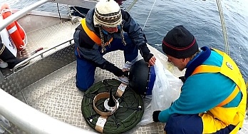
Autumn will be dedicated to prepare the winter camp: preparation
of the boat, installing the windmills and the scientific equipments.
The days will get shorter and will give place to the first
snowfall, the autumn storms and the formation of the ice.
The remaining summer crew will leave the boat once the ice
is formed.
To be continued.
(*)Thule
|  Moorings :
Fan Gletscher (77°32.5N 69°54.8W): mooring
to the W of the delta formed by the streams coming form
the glacier, opposite of Herbert Oe. Excellent hold
in 7m sandy ground. Open to the S.
(***) Qaanaaq (77°27.9N 69°16.6W): very good
hold in 5m in sandy ground. 5-6 cables to the W of the
village. Protected by some underwater rocks that are
visible at low tide forming a small bay, providing shelter
from the drifting ice. The approach is though a narrow
passage, 2.0 to 2.5m depth at low tide, 77°27.8N
69°17.0W coming from the S. The depth in the bay
is around 5m. No protection from the wind nor some swell
at high tide. Access to shore by dinghy on the beach
towards the village. 3/4G network. Don't miss à
stop at Qaanaaq Hotel! |
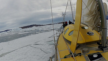
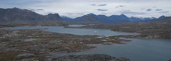
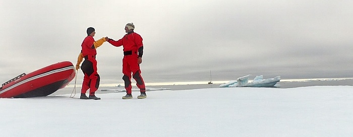
Leg
6 : The most northern settlement on earth (September
8th, 2015)
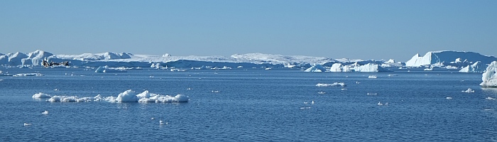
Melville Bay (photo Peter Gallinelli)
The crossing of Melville Bay was fast. Half of the bay we
were able to profit from NE winds, which slowly calmed down
forcing us to continue by motor. The days are still long at
this latitude; the sun disappears behind the horizon for a
few hours, leaving nonetheless a blue twilight. Enough to
see the small bits of Icebergs that cross our path!
Our compasses start to mislead us, they are no longer accurate.
When the sea is a little rough, the swell makes it hard for
them to show a constant heading. The magnetic deviation is
about 60°. Here this instrument that is key to accurate
navigation comes to it's limits. We now follow the wind and
the indications of our GPS.
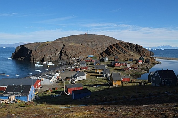
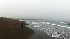
Siorapaluk, the most northern village of the world (77°47'N),
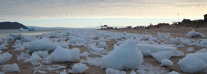
Robertson Fjord (photo Peter Gallinelli)
We are back from Siorapaluq, the northernmost settlement
in the world. After speaking to the locals, we have yet again
lots of new and useful information on the area. Combined with
the information from our maps and satellite photos, it allows
us to identify potential mooring places for our winter camp.
Once these places are virtually located, we still need to
go on place and carefully analyse the pros and cons. We are
looking for several qualities: first of all protection from
the open sea and drift ice, proximity to a village, access
to a fresh water source (if possible) and finally, not to
be to much closed in order to be able to take advantage from
the wind for our windmills. Ideally would be an open view
towards the S to see the first (and last) sunbeam!
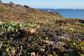
Walking through the toundra, Robertson Fjord (photos Peter
Gallinelli)
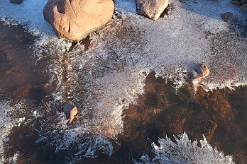
The end of the summer is approaching. The little streams
are freezing, for the first time we have a little ice on our
deck. Our winter camp is not yet defined, mooring possibilities
are scarce in this area...
|
Moorings :
Qeqertarssuaq (77°25.4N 70°14.0W) : good hold
in 5m sandy bottom in a little bay open to the NW (find
a spot between the algae). Make a big turn around the
W of the islets that close the bay to the N to avoid
underwater rocks in the axis of the islets. Do not go
further into the bay as the Islet to the W, there are
numerous rocks! The end of the bay is dry at low tide.
The abandoned village is 1.5km to the E of the mooring.
There are several turf ruins along the coast.
Barden Bugt (77°08.7N 70°43.1W): landlocked
mooring with excellent hold in 15m sandy bottom, aprox.
80m from the beach at the end of the fjord behind a
'moraine'. Keep clear of shoals close to the different
'moraines' and Kap Powlett. Remains of an abandonned
village along the N coast of the fjord. Glacier landscape.
Over night there is a cold breeze blowing from the glacier.
A potential winter camp mooring? To be tested in strong
winds from the W (uncomfortable swell from the side
may occur).
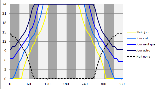
Info:
The following graphic shows the daylight over the year
at 75° N:
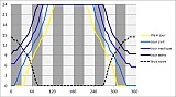
Graph : horizontal axis = number of day; vertical axis
= number of hours. For definitions of civil, nautical,
astronomical day, please refer
to... (clic = zoom)
|
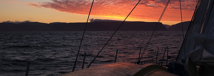
Leg
6 : The arctic route (September 2nd, 2015)
This morning the summits of the surrounding mountains are
covered in frost. The weather forecast for Melville Bay predicts
-5°C. Upernavik is in the south. More and more, the landscape
shows its true nature: blank rough rock. Our voyage continues
North. The weather is on our side, although the lack of wind
forces us to use our motor to trace our way. August-September
is the period with least ice, allowing us to reach far into
the fjords.
Approche de la côte au petit matin après une
nuit de près en mer (photo Peter Gallinelli)
The region of Upernavik is a paradise for every climber and
alpinist. Majestic granite walls reaching steep into the sky.
Big valleys, covered by a rich flora lead to snowed in summits
up to 1500m. We are on the lookout for future travels, writing
down what we see around us for future planning.
But while our imagination is already in the future, the
present has us searching for possible winter camps. There
are quite a few possible spots that would be suitable for
the winter, even though the ice arrives relatively late in
this region (December-January) and is quite thin (20-40cm).
This can be a problem, as a lake of thick ice reduces the
possibilities to travel freely between the winter camp and
the close by village making access for friends and family
difficult. During the delicate periods of freezing and melting
of the ice, while the boat is not yet strongly frozen in by
the ice, we are exposed to winds and drifting ice.
We approach the glacier front of Upernaviks Isfjord. The
glacier has retreated tremendously: we manage to go 20km deeper
into the fjord as was possible 20 years ago according to satellite
photographs of that time. Some lakes have simply disappeared.
The landscape still has the visible marks of the former presence
of this great mass of ice that has completely vanished as
for now.
At the foot of the glacier we find a little unexpected anchorage
freshly uncovered from the ice (*). As always we profit immensely
to go on land and discover this so absurd landscapes and are
surprised by the speed with which new life takes hold on these
uncovered rocks.
Nanuq crossing Upernaviks Isfjord (video extracts Kalle Schmidt)
Isfjord also gives us the first opportunity to touch fresh
ice. While the verge ice explodes with the sound of broken
glass, the 15cm thick ice sheets crack with a deep thundering
sound. We discover Nanuq in another light. The reinforced
bow easily pushes the big ice blocks that float along our
flanks side, cleaning the hull from algae. The safety fuses
of our tilting tiller work, avoiding destruction when we hit
a big block of ice.
Although the enthusiasm is very high we have to keep in
mind that we are exposed to the elements and that caution
and attention are essential. The possibility of a storm is
high during autumn, so we always have an open eye for a protected
plan B.
While the voyage goes on, so does our scientific program:
two weather buoys have been launched and are drifting in the
Labrador current, a third one will be launched in Melville
Bay. The absorbers from the Université de Savoie are
soaking up particles and for the Université de Brest
we are collecting water samples every 3 or 4 days.
Every day brings us something new: a new experience, a new
encounter, a new environment. The versatility of this country
is breathtaking even though it's ingredients are so scarce.
It is this ever changing coast that surely gave name to this
country as well as its people, as it is the country of man.
We are impatient to go into the coming season and experience
this beautiful country under a different light.
|
Moorings :
(*) Isfjord, island without name (72°48.2N 54°15.5W):
13m deep, fine sand bottom. Good hold for anchor in
good weather. Possibility to access the Greenlandic
Ice-Cap. Beautiful sight onto glacier.
Fjord without name (72°48.2N 54°15.5W): very
good mooring protected from the wind and the ice. Sandy/muddy
ground with good hold (algae can be avoided). The end
of the fjord is accessible with some local knowledge
(rocks in the passage - pre-sounding with dinghy recommended).
The little bay at the end of the fjord is potentially
an all weather/all year round mooring place. Fresh water
stream close by, on the exposed S side of the bay. There
seem to be some rests of a summer camp of local fishermen.
The big waterfall shown in the N of the fjord no longer
exists.
Appilattoq village (72°52.3N 55°34.2W) : excellent
small natural harbour used by local fishermen. Good
hold in the middle of the main basin at 13m, in sandy
bottom (depths vary between 6-18m). Approach from the
W through a little passage. It is recommended to stay
in the middle (8m), as there are some rocks to both
sides close to the shore. Care should be taken when
moving inside of the bay as there are some isolated
underwater rocks in the main bay and the passage leading
to the smaller bay to the E. Fresh water lake 15' away
by foot. Distance to inhabited village ~2km - easy walk.
GSM connection.
Atiligssuaq (72°46.9N 55°51.4W): small bay
perpendicular to the main fjord. Well protected from
the predominant winds. Sandy bottom (unverified hold).
Good mooring can be obtained by anchoring in 12-15m
water and attaching two lines to the shore.
Bay to the South of Umiasugssuk (72°45.8N 55°53.9W):
good anchorage on sandy/rocky bottom. Small beach on
the S of the rocky isthmus that closes the bay to the
NW. Steep mountains on both sides of the bay. Many climbing
possibilities. Several waterfalls in the surroundings.
Old snow at sea level (August). Quite visited by locals.
Avoid mooring to close to the flanks of the mountains,
danger of falling rocks!
Nutaamiut (73°31.1N 56°25.1W) : Village marked
as disused on charts but inhabited: new infrastructure
(fishing plant, GSM antenna, houses). Anchorage can
be found to the E of the GSM Relay antenna (50m from
the chapel) at 0.2nm from the cost. Sandy/rocky bottom,
6m deep. Caution is advised, there are some shallower
spots. There is no peer, but a protected stone wall
equipped with rubber tyres at the foot of the crane
to the S of the village. The anchorage is not well protected
from ice although shallow bottom keeps big icebergs
away. |
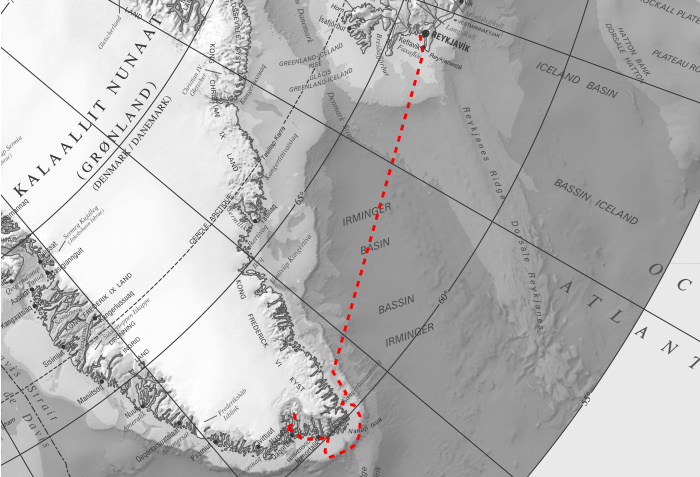
| LEG
5 : 650 miles: crew 8 : 15 days |
|
| Background source : Atlas of Canada
- The North polar region, see atlas.gc.ca
|
Leg
5 : on our way to Upernavik (August 25th, 2015)
After a few days without connection, we're back with some
news! We have used these days to complete some of the older
articles, enjoy the reading!
After Ilulissat, the contrast is quite accentuated when
we moor in a little bay off Sarqaq, a little peaceful village
home to the arctic garden that once belonged and was cared
for by Hanibal Fencker. Two big greenhouses are the shelter
to numerous plants. When we open one of the doors we are welcomed
by the image of a little tree just as tall as us and the aromatic
smell like we haven't smelled in a while. In the fjord enormous
blocks of ice lie peacefully close one to another. In the
evening we are surprised by fireworks. The people of Sarqaq
are celebrating! There is joy in the laughter, the music is
loud! It is Saturday, time to celebrate, also on board.
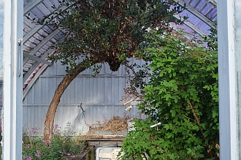
Sarqaq: Icebergs and dogs enjoy the peace. Hanbibal Fencker's
garden (photos Peter Gallinelli)
In Sarqaq, as well as most of the other villages, the fuel
tanks show the dependence of fuel in this regionsl (photo
Peter Gallinelli)
The next morning we continue our way. In front of us we have
the Vaigat: an unprotected passage to the North of Disko Island.
It is 6o miles long and 10 miles wide (twice de size of the
Lac LŽman), with no really mooring possibilities. To
the North we find the Nugussag peninsula, crossed by big semidesertic
valleys leading to high, snowed-in peaks. It presents itself
as a magnificent hiking area, ready to be exploredÉ
We could spend weeks here; definitely a place to come back
to!
The following days are marked by the welcomed presence of
the sun. We are heading north; every degree we get closer
to the North Pole, leads to the loss of a degree in the height
of the trajectory of the sun. The scarce flora is changing
its colours from green to red and orange. Everything seems
to retreat back into its roots. The cormorants are heading
towards the South. The winter is approaching.
Mushroom season. Niaqornat (photos Peter Gallinelli)
After spending the night in the cover of a big wall S of
Nugsuata (**), we head to Niaqornat (***), the Village at
the Edge of the World. It is a meeting point between arid
mountains and the rough sea. Time passes differently here.
It is a village of contemplation. At the beach the grandfather
plays with his grandchildren, throwing stones.
The only person that speaks english manages to download
the GRIB files for us. Internet access exists in every inhabited
village in Greenland. Therefore, we use the mobile coverage
maps, to find out if a place is inhabited.
GSM coverage map. 2G and sometimes even 3G (map extract ©
TELE-Greenland)
After a short crossing over the Ummanaq fjord, we arrive
in the Upernavik area (****). The landscape completely changes.
The deep valleys and volcanic formations change to round polished
granite. While the mushrooms dry on the navigation table,
we cross the 70th parallel N.
[...]
|
Moorings :
(*) Sarqaq (70°00'N 51°57'W): good anchorage
inside the little bay to the S of the small village.
Protected to the S by a little island and 1m shoal.
Excellent hold in sandy bottom (5-10m). Fuel available
on the peer. Small shop. Nosy-Bé wintered here
in 1996. Well mapped on charts.
(**) Temporary mooring to the S of Nugsuata (70°40'N
54°34'W): well protected from the dominant winds
from NW and SE. Open to the sea to the S and W. Good
hold in rocky bottom covered with algae (11m), close
to a pebble beach at the foot of a stone wall. Volcanic
origin. Surrounded by beautiful valleys, with mushrooms
and berries. Some Inuit tombs.
(***) Niaqornat (70°47'N 54°34'W): Small village
installed on an isthmus. Beautiful surroundings with
great hiking possibilities. The mooring is situated
on the W of the isthmus. Good hold in calm weather in
15m sandy bottom around 15m from the beach. Open to
the NW and only protected by big icebergs grounded on
the shallow bottom.
(****) Mooring to the S of a glacier 'moraine' at the
W entrance of Amitsup Suvdlua (71°49'N 55°24'W):
Good hold in 10m sandy/algae bottom. On the shore there
is an old hunting cabin. The 'moraine' is not shown
on charts but can be seen on satellite images. Arid
surroundings, amazing hiking terrain! Close to the beach
there are some rests of turf houses and a tipi camp. |
Leg
5 : Sisimiut and the route of Sila (August 19th,
2015)
For the last days we have been slowly proceeding north. The
extensive archipelago along the coast offers the most numerous
oportunities to explore the different landscapes. During the
day we enjoy the calm and protected waters between the islands.
In the evening, after securely mooring in a small bay at the
foot of some mountain or the mouth of an extensive valley,
we go for a hike in the surroundings.
Today, after searching a mooring, we make a stop in a little
village with about 20 small houses. Only 5 minutes after arrival,
we are approached by Stephen. He is the teacher. He invites
us to come to the school for a morning coffee. He asks if
we could talk about ourselves and what it is that we are doing.
20 pairs of young eyes stare with excitement, carefully listening
to what we are saying. There is joy: the children gloat with
enthusiasm and present big smiles. We are touched by the openness
and kindness of our hosts. The young Greenlandic woman who
will take over the teaching in the village thanks us for the
visit. We are grateful for the kind and humble invitation
to spend a day among these kind people. We'll come back!
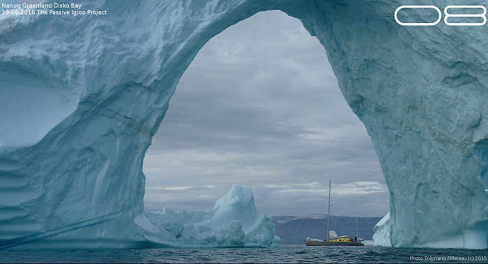
Nanuq under an iceberg in Disko Bay, close to Ilulissat (photo
Sréphanie Piffeteau)
Travelling with a boat somehow opens doors towards people,
allowing us to exchange ideas, share thoughts and, mutually
learning from one another. Martin, for example, is researcher
in building physics for the Danish Technical University and
our contact in Sisimiut. His domains are ventilation and thermal
insulation in arctic regions, topics that are not strange
to me.
He shows us the two prototypes of passive buildings that
exist in Sisimiut, welcomes us to his lab and offers us the
services of his workshop. This allows us to fabricate the
mast for our windmill. In return we organise a conference
and tour on board for the students of the summer camp. We
will stay in contact, the first results of our expedition
are awaited with great interest.
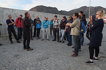
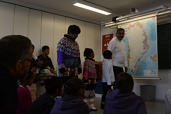
Peter explains the 'passive igloo' to
students of the Danish technical university / proud and spontaneous
demonstration of traditional Greenlandic costumes (Photos
Lisa Gallinelli, Kalle Schmidt)
After spending a night in Quequertarsuaq, Disko Bay, we head
to Ilulissat. Surrounded by blocks of ice, it's a busy city,
marked by tourism; Greenland's Chamonix. We find nearly everything
that is still missing, at high prizes obviously. Most importantly
though, coincidence has it that we lie side by side with Vagabond
(link). Eric and France share with us precious information
and advice about the region we are heading towards. More importantly
they share with us moments of first friendship.
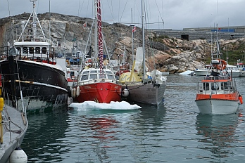
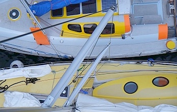
Vagabond and Nanuq (Nanuq and Vagabond on the right) together
in the harbour of Ilulissat - autumn 2015 (photos Peter Gallinelli
/ Kalle Schmidt)
Meanwhile their two daughters, Leonie and Aurore, spend the
day together with our young crew. Later, a customs-agent comes
on board. He had seen us loading dog food onto our deck and
wanted to make sure we didn't have any dogs on board coming
from the south. They would have to be castrated in order to
preserve the Greenlandic sledge dog gene pool.
The day passes too fast between buying what we need and
visiting the town and the three expedition boats: Vagabond,
Atka(*) and Nanuq(**) - all full of innovative and unusual
conceptual ideas. They are floating innovation labs. At 22
UTC, after a long day, we cast off 5 miles to the North of
Ilulissat into a little bay. More and more the maps become
schematic, giving us less and less detail and more discovery.
More to come!
(*) Périple
50
(**) Intégral 60
|
Moorings :
() Sydbay (67°13'N 53°53'W): In contrary to
the instructions found in Imray, the anchorage to the
N is not strong enough for strong winds (20knots) from
the S (to deep and to many algae). Excellent hold can
be found to the W of Ukivik in 12m sandy bottom. Protected
by several awash rocks to the SW of the island. Visiting
the island is recommended: the view from the light house
and the the well conserved turf house are extraordinary.
(*) Ikerasarsuq (68°08'N 53°27'W): The rocky
and deep bottom is not suited for mooring. There is
however a little peer suited for a short stop. The small
village lies out of the way of the main touristic route.
(**) Hunde Ejland (68°52' 53°07'W): Small unvisited
village situated on an archipielago at the entrance
to Disko Bay. Approach to the little harbour through
the N/S channel to the E of the archipielago. Aim towards
the little peer to the W, avoiding the visible rocks.
There are some 6m shoals. Fresh water is produced by
reverse osmosis.
Bredebugt (69°16'N 50°58'W): Small bay on the
S side of the main bay, 5M to the N of Ilullisat. Good
hold in 6-8m sandy bottom. Depth close to shore is around
5m. Size limit, the use of land lines may be recommended.
|
| LEG
4 : 630 miles : crew 7 : 13 days |
| |
| Background source : Atlas of Canada
- The North polar region, see atlas.gc.ca
|
Leg
4 : the long route North II (August 14th, 2015)
Our GPS indicates 66°33' N ; we are crossing the polar
circle for the second time this summer! And we celebrate it:
Peter and Mathilde drive over it with Nanuq, Lisa and Jakob
with the dinghy, Ilona and Alina cross it hanging over the
water from the boom and Kalle swims over it! For us it's a
symbolic line: we are in the arctic again! Also the landscape
gives us hints that climate is slowly getting colder. The
relative green hills are slowly turning into grey rocky mountains.
Glaciers cut through this rough scenery. We have to start
looking out for Nanok, the polar bear. We carry with us some
flares, just in case.
The polar circle is also the border between the agricultural
South and the dog sledging North. There is even a law that
prohibits sledge dogs further south of the polar circle. We're
entering the Greenland inhabited by the hunter.
Nanuq moored in a bay a three miles north of the polar circle
(photo Peter Gallinelli)
The wind in this region follows the coast. So forecast is
rather simple: head wind, wind from astern or no wind at all!
It is far from ideal when sailing. We either decide to head
onto the open sea sailing long legs or we follow the calm
inland route slaloming in-between the islands. The inland
route pleases us. It needs attention to detail, but allows
us to get a real feeling of the vast array of possibilities
that this coast has to offer!
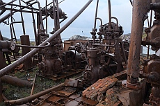
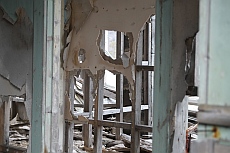
Ruins of an old factory, abandoned houses, half a century
old glass wool insulatione (photos Peter Gallinelli)
In Nuuk we manage to buy most of the equipment we are still
missing for the rest of the trip and most importantly the
winter expedition. We buy the last 3rd of the nutrition thanks
to the help of the local team of Greenland's main food supplier.
We are happy that the food is so far on board as it is our
fuel for the winter!
We try to avoid pre-cooked dishes and dry-frozen foods.
Rather we stock on basics: rice, pulses, flour, oil, butter,
sugar ... but also peanut butter, honey, jam and a big stock
of Wasa bread. To complete our diet we'll have to fish and
maybe hunt once in a while. So far the ocean has been very
kind with us, offering delicious cod. Variety will come in
the creativity with the recipes!
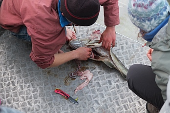
Daily catch. Alpine background; snow at sea level (photos
Peter Gallinelli)
We will soon arrive in Sisimiut. Another leg comes to an
end, a new team will come aboard. Every two weeks we make
a strategic stop. Replenishment of fresh food, water, and
any other missing item. These places can be reached by plane
or by boat opening the possibility for people to join us if
they so please. Each crew change leads to a different on-board
dynamic, to new encounters and exchanges. It's a way of sharing
experience.
In Sisimiut we buy a rifle. It will serve us as protection
in case of an unfriendly encounter with the polar bear. Sisimiut
marks the end of leg 4 and the beginning of a new one. There
is fresh snow at 500m, the thermometer marks 5°C on deck:
summer in Greenland!
|
Moorings :
(*) Tovkussaq (64°52.8'N 52°11.8'W): Good hold
to the N of the bay in 5-10m sandy bottom. Fresh water
can be obtained at a small waterfall to the W of the
bay (metal ring in the neighbouring rocks).
(**) Tasuissaq (65°34.8'N 52°46.2'W): Good
hold to the NNE of the bay in 10m sandy bottom. Beautiful
hiking in the surroundings with beautiful view to the
W. In proximity of Maitsoq. Very alpine.
(***) Iserkuq (fjord). Several mooring possibilities,
one of them being 'Jak's Bay' (66°07.4'N 53°36.4'W):
Good hold to the S of the bay in 18M muddy ground. Small
waterfall top the W of the bay with metal ring. Very
rocky and arid surroundings. |
Leg
4 : the long route North (August 6th, 2015)
Leaving Narssarssuaq, Nanuq makes her way towards the open
sea, leaving the sheltered and warm fjords of the SW-coast.
We're heading NW on the inland route, passing one abandoned
village after the other. The crew has to get used to the waves
again when we get to the open sea, after weeks of calm water.
Next port
of call: Paamiut, a small town with its 1600 inhabitants.
Now obsolete buildings, built in the 60's, are being dismanteled.
They are cold, empty, unpersonal, inadequate, symbol of some
kind of modernity that surged in the transition between traditional
ways of living and the contemporary danish model of living.
Paamiut - buildings from a low-cost post-war urbanization
(photo Kalle Schmidt)
After 2 hours, just enough time to do buy some fresh food
for the following days, we cast off to continue our route.
The North is our destination! One evening we moor close to
a small village. A handful of colorful houses stand spread
over two hills. We are eager to find someone to talk to...
It seems liked there is live. Curtains hang behind the windows,
there are sofas on the porch, there are drawings on the walls
and flowers standing on the table. We are surprised when we
take a closer look. The curtains have lost their original
colour, the sofas have deep holes and the paint on the walls
is falling off. It seems like we have arrived in some kind
of ghost town. There is no one left here. It seems like everyone
droped whatever they were doing and left. Decay apperas everywhere
due to the wind and the cold. It makes us think of an old
Inuit proverb: ''Siku
Silalu kisimik naalagaapput' - 'The only masters are
ice and time'.
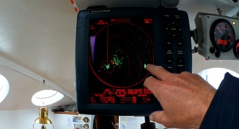
We leave early in the morning, swallowed by a dense fog.
Without being able to see much further than our anchor, we
cautiously follow our radar and echosounder. Navigating in
these conditions, makes us appreciate even more the sense
of adventure the former navigators had when they discovered
this area. They ventured into the unkown without any, charts,
meteorological data or precision instruments. They solely
relied on their experience and knowledge of things we have
likely forgotten about. Only part of this knowledge is transmitted
in the sailing directions we can buy today.
The fog
slowly transforms into a bright white mist, iluminated by
the hiding sun. We seem to float on a completley blank sea.
It seems like our perception of the world has shrunk down
to a radius of 200m, static, with time moving at a different
rhythm. The route through a labyrinth of rocks and shallow
water is possible thanks to the directions and charts. At
noon our anchor takes hold on a good sand ground. We discover
Sioqquap Sermia, a huge sand beach at the foot of the big
greenlandic ice cap that nourrishes this endless delta.
Sioraq - sand as far as the eyes can see (photo Peter Gallinelli)
We take a few steps on land, enough to give us a feeling
of the inmensity of this place. It makes us aware about our
place on this planet that is so beautiful and hostile at the
same time...
|
Moorings :
(*) Siorak (62°28.8'N 50°19.0'W): Good hold
in sandy bottom protected by the little islets to the
S. Not recommended unless the weather is calm. Possibility
to make a short visit onto the amazing sand beaches.
The inland route is exposed to the wind and waves from
the W. Charts are quite vage and not 100% in accordance
with GPS positioning. Caution! |
| LEG
3 : 1060 miles : crew 11 : 16 days |
| |
| Background source : Atlas of Canada
- The North polar region, see atlas.gc.ca
|
Leg
3 : South-West Greenland (August 6th, 2015)
After 6 days on the open sea, we have made a radical style
change: during 10 consecutive days, Nanuq becomes a moving
base camp. We head from one mooring to the other, exploring
the grenlandic backcountry. A wild and rough mixture of rock,
green patches and ice, trenched by numerous fjords. This vast
land, once the arriving point for Eric the Red, offers its
beauty to those who come to see it.
Our topographic map coves an area equivalent to the size
of Switzerland. The possibilities for any mountaineer are
endless, it is empowering and discouraging at the same time:
the hardest part being where to begin... The terrain is rough,
it seems unpouched by human, only the tracks of animals can
be found. It is exciting to discover this new and unknown
landscape, sometimes hardly accessible...

Nanuq mooring in Stephenses Havn (photo Peter Gallinelli)
The nights, mostly with clear sky, allow us to profit from
the cosiness inside of the igloo. The
mornings are something magical. The fog lies thick on the
water surface, the water is like a mirror, a thin crust of
fresh ice floats on its surface. The melting water from the
ice cap, floating on the salty sea water, freezes easily at
night. There is absolutley no sound. A bit further away from
the glacier, the water is at +10°C, similar to the water
we can find in the north of Scandinavia. It is to warm to
start cutting the wheel of Compte,bought in the Jura in June,
which is enjoying the freshness of our hull.
It is the end for some of the Crew. Their plane leaves from
Narsarssuaq. It is wind still, warm and dry. There is a feeling
of abandonment and "end of the world" at this place
that calls itself the "Hub of the South of Greenland".
Discovery at he base of the ice cap- Warm bath with 'dressing
room'' - time to DIY (check out the T-shirt!) (photos Kalle
Schmidt)
Coincidence makes us meet Agathe, french architect living
in Greenland. Together with her husband Kalista, they have
around 300 sheep, being one of the 37 farmers that are located
in the SW of Greenland
(http://www.ipiutaq.gl). It's a country for people
who have the character to live in full autarcy and who accept
periods of complete isolation and loneliness.
|
Moorings :
(*) Qaleragdit Ima (60°59.4'N 46°40.4ÕW):
Anchorage at the foot of a temporary tourist base camp.
Beautiful view on the ice cap. Good hold in 15m sandy
bottom. Other mooring possibilities closer to the ice
cap to the E of the fjord. The foot of the glacier,
little active, is 2NM further N than indicated on the
charts.
(**) Little well protected bay (61°00.1'N 46°34.9,W):
Anchorage in 10-15m sandy bottom. Approach to the bay
from the E through a narrow passage, 4m deep in high
water. Stay in the middle, there are quite a few shoals
on both sides. Caution!
(***) Ipiutaq (60°58.3'N 45°42.7ÕW):
mooring in a little bay, at the foot of a small sheep
farm, on the N side of the Fjord leading towards Narsarssuaq.
Good hold in muddy/algae bottom. The bay is 25m in the
middle ascending to 5m towards the coast. Friendly farmers
couple with daughter always open towards visitors (http://www.ipiutaq.gl). |
Leg
3 : Greenland approach (July 25th, 2015)
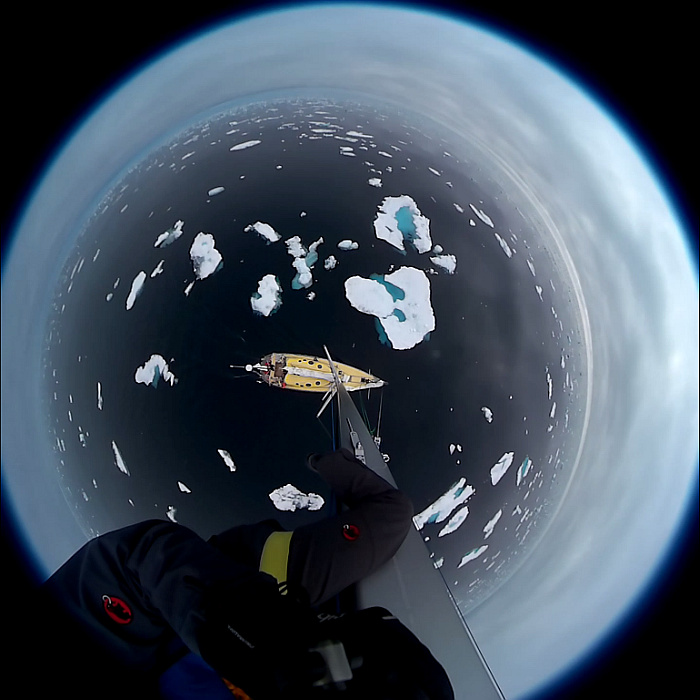
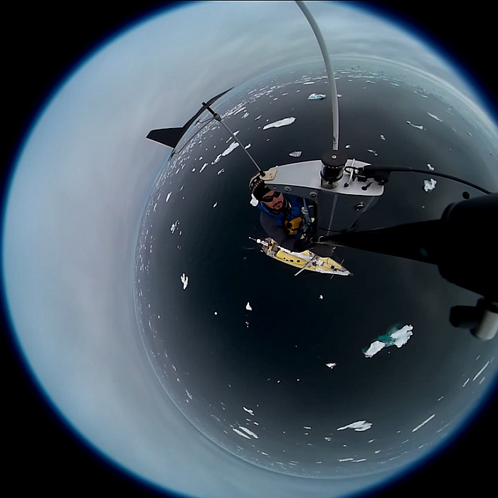
It is 7am UTC - LAND IN SIGHT!! The first ice touches the
reinforced sides of our hull. Big smiles on the crew's faces
show their joy to see the first ice bellow the sharp mountain
peaks. We arrive in a world where the mountains join the sea,
glaciers licking the salty water of the atlantic - a dream
for every Mountaineer-Sailor..
Landfall Greenland East coast unfortunately
still inaccessible at this time of the year (photo credits
Kalle Schmidt)
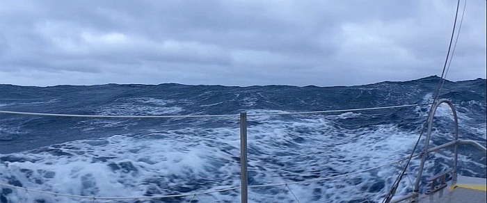
The crossing was a pleasure for everyone onboard. With winds
between 25-40knots made it possible to sail 600nm in three
days. On arrival in Greenland, the ice conditions on the East-Coast
make it impossible to reach land. it takes us two days to
make our way around Kap Farvel, making our way through a sea
of icy bits, always bordering the ice belt. Yet again, as
on the North-Coast of Iceland, we are being swalloed by a
dense fog. With low visibility we make our way through the
cold labyrinth of turqoise ice, with the help of corse of
our radar and the compass. The water temeprature is around
1.5°C, the saturated air around 10°C. The crew is
confortably covered in warm layers!.
Landing on a piece of shelf ; in the far background our companion,
Nanuq (photo credits Peter Gallinelli)
6th day on the water: we slowly make our way pushing the
blocks of ice with our hull. We have 3 Crewmembers on deck,
always on the look-out for submerged bits that could harm
our rudders and propeller. The concentrate dice serves as
a buffer, leaving behind a calm slowly moving sea. The line
between water and air becomes mear imagination. from time
to time a group of seals create a contrast to the grey-white
background. They seem unsure of our presence, not knowing
whether to fall back to their sleep or leap into the water
and disappear. These conditions are perfect for us to venture
ourselves to discover the greenlandic floes in our dry-suits.
CLIC
= ZOOM

Sailing around Kap Farvel - following the ice edge (photo
credits Peter Gallinelli, Alain Berthoud).
The night last 4 hours at 60°N. We decide to retreat
into open water and dirft, navigating without light in the
dense fog, seems like a bad idea. The hourly shifts continue,
now destined to spot the ice around us. We slowly drift towards
the south due to the Grenlandic Current. It is calm, the sound
is absorbed by the fog and the ice..
This rythm allows us to through our first meteo buoy over
board, send to us to Reykjavik by Météo-France.
Equiped with precission equipment they are destined to meassure
different parametres that will help the understanding of our
environment, the different parameters that influence our climate.
Also, the data will be used to elaborate a more accurate wheather
forecast for navigation, especially for small scale boats
like us (see
science...).
We see several groups of Orcas. They travel silently between
the ice: no splash, no waves. We only know of their presence
because we can see them. They come to the surface at regular
intervals, moving through the water at considerable speed.
It is beautiful to watch these creatures where they belong,
we are in their home...
Unpackaging a SVP drifter buoy | RADAR navigation through
ice : floes and a bigger berg on starboard (photo credits
Alain Berthoud, Peter Gallinelli)
After another night drifting South, we do the last miles
until we finally see land again. The moment the bottom of
our shoe touches the happiness rises. We have arrived in Greenland!
A rough but breath-taking landscape of peaks, glaciers and
fjords sorrounds us. We have moored close to an abandonned
village. Small concrete cottages give us anj idea of the dimensions:
small, one house not far from the other, cosy for the winter
months. One of the houses seems to be still a summer retreat,
the open door and the interior giving the impression that
it had been left in a hurry.
The grenlandic flag flies under our starboard spreader in
the slight wind. It is Lisas birthday!
Before heading to Nanortalik to buy some supplies and post
these news, we make a stop at Tasermiut. A big fjord, sorrounded
by high peaks, at its end a big glacier. We go on land to
hike, a wonderful pick-nick in our backpacks. Some go back
onboard, others stay a bit longer. In the morning part of
the crew returns on land for a morning hike and some bouldering.
We see a pair of Imperial Eagles. A place to come back to!
Leg
3 : voyage to Greenland (July, 22th 2015)
600 nautical miles (1100km) separate Island from the E-Coast
of Greenland. The wind blows strong from the North, coming
at us with speeds up to 40 knots. The sea is rough, waves
up to 4m roll in from atern pushing and pulling. We sail under
small jib and 3rd ref, doing an average speed of 9-10 knots.
From time to time a waves breaks on our bow, shovering everything
and everyone on deck. It is a game with the waves. Nanuq is
in his element! We can hear in shout with joy each time we
surf down a wave! Seasickness is oly temporary and soon everyone
has a big smile on his face. The warm cabin is a welcomed
resting place after the two hours in the cold and wet win.d
Sky and sea - gale SE of Iceland (photo credit Peter Gallinelli)
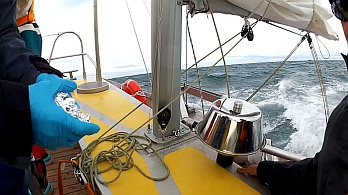
Leaving Island we install the atmospheric and underwater
PCB-captors. The samples (collected by passive absorbers)
will be analysed later by the LCME of the Université
Savoie Mont-Blanc. (see science...
)
 Installation of PCB measurement equipment, Iceland 64°02'N
22°58'W (photo credit Alain Berthoud)
Installation of PCB measurement equipment, Iceland 64°02'N
22°58'W (photo credit Alain Berthoud)
As expected, the wind slowly gives away. The clouds give
way to the sun, the sea becomes calmer the wind disapears.
We continue under motor, moving through a smooth sea that
reflects the sky as if it was a mirror. We are in the middle
of nowhere, a minuscule point in a big ocean. Life on board
now focuses on other rhings than wind and waves. The crew
draws, reads and writes. The notion of time disipates into
the savouring of the present. The kitchen becomes the centre
of the life onboard. Music of all kinds, at different moments
make the mood. Everyone
looks for something to do while off shift.
We are
followed by daulphins on the way and once in a while a humpback
whale shows us his back.
Land
is at 100nm. The crew is impatient to see the first signs
of land!
Leg
3 : departure to Greenland (July, 19th 2015)
The new crew is on board and enjoys a last visit to local
the swimming pool with unlimited hot water! Packets with scientific
equipment arrived and we have embarked the weather buoys.
The scientific program can finally begin.
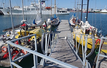
Imram and Nanuq side by side, Iceland
(photo Kalle Schmidt) - sailors from the whole world
meet at the visitors ontoon in Reykjavik (photo Victor Guillot)
In Isafjöordur
we meet Imram, the former boat. Under the flag of his new
captain he is waiting the arrival of his crew in Island, planing
to also make a visit to the East-Coast of Greenland this summer
(http://www.imram.fr).A
short visit aboard brings back memories of past adventures
(http://voyage.sailworks.net).
We are at the western end of Iceland, prepared to cast off
for a 500 miles crossing where we will be cut off from the
world. Landing on the east coast of Greenland will be in 4
days. At the time of writing the access is still impossible
due to the belt of drifting pack ice along the coast coming
down from the Arctic.
| LEG
2 : 960 miles : crew 11 : 12 days |
| |
| Background source : Atlas of Canada
- The North polar region, see atlas.gc.ca
|
Leg
2 follow-up : tour around Iceland (July, 15th 2015)
We are making our way around the North Coast of Iceland,
discovering its rough coastline interrupted by beautiful fjords.
Steap hills with snowed peaks rise on both sides of these
fjords, some giving shelter to small fishing villages. We
passed caps like Langanes and the Horn, known for the strong
currents that flow in their vicinity, the vicious storms and
the icy winters. It
is a cold summer, the thermometer never over rises above 10°C.
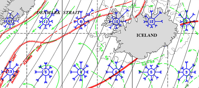
Extract of american 'Pilot Charts'.
The windroses show the predominant wind frequency by sector,
Tassilaq region in the west.
These past days the wind has predominantly been blowing from
the NE, as the 'Pilot Charts' confirm for the month of July.
Blowing at speeds up to 25 knots, we make our way steadily
towards the West. The weather on the other hand is much less
convincing. It is humid, cold and the constant dense fog not
only makes our shifts slightly unconfortable but also creates
the sensation of being lost in space. We have no reference
of moving on, except the hourly GPS-point. The visibility
is often of less than 1NM, making the approach into a narrow
fjord a tricky maneuvre and the image on our Radar is of great
help for a safe landfall. Where is the SUN?

Approach of Isafjordur (credits photo
Peter Gallinelli - Kalle Schmidt)
Discovering the N-W fjords
Black sand beach at Hornvik / more or
less wet crossing of more than one stream / drying our wet
clothes (credits photo Peter Gallinelli)
If there is one word to describe the fjords in NW of Iceland,
it would be vastness. It is a wild, continous coastline of
rough steap cliffs, mountains reaching to the sea and beautiful
beaches of black volcanic sand. One of the most solitary and
untouched places in Iceland, they are full of endless possiblities.
There are valleys crossed by uncountable little streams, mountains
with snow on their peaks and waterfalls of all sizes. The
fog adds yet another dimension to this already mysterious
landscape, hiding some of nature's beautiful corners. Our
hiking is a little adventure for some of our crew. The fog,
the rough terrain and the icy streams that we have to cross,
are new to some and make each time we leave Nanuq an exciting
event. Nevertheless, it is always a pleasure to be able to
return onboard our warm and cosy Igloo, completeley soacked,
our wet and cold feet screaming for new socks. A cup of warm
tea and a little something to eat always brings colour back
to our faces.
Whereas human traces are rare in this area, we find from
time to time groups of huts. Some of them are inhabited during
the summer months, others show the signs of the cold and the
wind on their walls. While we can see that it is not a place
destined for our species, we are overwhelmed by the abundance
of wildlife that is present in this region. We have seen arctic
foxes looking for food on the beach, a great number of birds
nest in the valleys and cliffs of the fjords, and occasionally
a whale sbhows its fin, to the crews delight. From time to
time, a group of dolphins follows Nanuq for a while.
We are now heading towards Reykjavik where our next crew
will be waiting for us. More to come soon...
Distance since Torshavn : 740 nautical miles
Leg
2 : arrival in Iceland (July, 8th 2015)
We arrived early in the morning in the little harbour of
Eskifjordur. We started on the Faroe Islands and with increasing
winds (up to 30knots) and developing sea, we managed to beat
our way over to the East coast of Iceland. Making our way
into the fjord, sorrounded by white peaks on both sides, we
were received by the kind words of the harbour master: "Welcome
to Iceland!...and of course you may use our toilet."
- both great news for the crew. During our crossing the temperatures
had already dropped considerably, being around 5°C in
the fjord. There is no longer need for a refrigerator as the
butter, being soft in Norway, is now hard as a rock. Water
is at 5°C. Fresh snow at 500m.
Nanuq sailing full power in near gale
conditions (extract from video footage Kalle Schmidt - having
a gigantic shower)
Cold wind blows strongly from the North, unusual for this
time of the year. We will have to wait till Saturday for the
change of weather predicted: 10-15knots from NE. After the
formalities with the custom officers we are allowed to step
on land and begin our exploration of the fjord and it's sorroudings.
Everyone spreads out into different directions. Some decide
to explore the valley and town, others head out to do some
hiking in the neighbouring mountains. The day is concluded
by a relaxing islandic bath in the local swimming pool...
sauna and thermal bassins (34-42°C), heated by the earth.
Heated to the bones, the crew is happy!
Land in sight / landfall on Island's
East coast /view over Eskifjordur (photo credit Kalle Schmidt)
We had a slight problem on our way. During our crossing we
hit a floating object with full speed, for our port dagger
board is severely damaged. Luckily we don't depend on it and
can continue our navigation even if we loose some degrees
to drift caused by the missing dagger board. The people from
Eskifjordur try everything to help us find solution which
will probably be in Reykjavik.
More news to come soon...
| LEG
1 : 820 miles : crew 11 : 9 days |
|
|
| Background source : Atlas of Canada
- The North polar region, see atlas.gc.ca
|
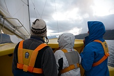
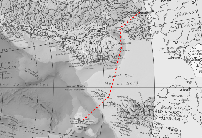
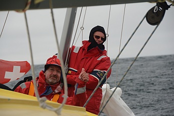
The
voyage begins here : Copenhagen to the Feroe Islands
(July 6, 2015)
Nanuq is making her way through the Northern Sea, towards
Fair Isle, a small island half way between the Shetlands and
the Orkneys. We sailed up the Kattegat, made our way West
through the Skagerrak with strong winds, and passed the oil
fields of Norway. The crew is slowly getting used to the wind
and waves, some at times still fighting sea sickness.
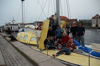
Crew Nanuq with core team in Copenhagen
/ Sailing (photo credit Kalle Schmidt)
Fair Isle is a wonderful little spot in the middle of nowhere.
The Vikings who sailed towards their raids used to call it
the "peacefull island". Our crew certainly can appreciate
this name. Between hundreds of different birds, some less
happy to see us than others, everyone spreads out in different
directions. Afterwards a good shower and a cold beer in the
local bar of the bird observatory.
Three days later we arrive in Torshavn, capital of the Faroe
Islands. We were welcomed by a generaous man, who after asking
if we ate fish, came with a beautiful fillet of bacalao and
another one of salmon. The crew which will be leaving us still
enjoyes the last moments onboard and the hiking possiblities
of the outskirts of Torshavn. Whereas the preparations in
Limhamn seem long in the past, there are still some ongoing:
acquiring scientific equipment, reacquiring of lost packages
lost in transaction, etc. We have to think of everything we
might need for a year because it will be hard to improvise
once we're in the north.
And then there is crew changes: meeting the new-comers, saying
goodbye to those we have come to know over the past few days.
We have come to know each other but also many others on our
way, mainly sailors but also locals to those places we passed
as visitors. These were rich encounters which make our travels
so worthwhile.
Read
older articles... |